Advertisement
Click to download now, finish the installation quickly, and directly unlock the "all-round experience"
Advertisement
Screenshots
Click to download now, finish the installation quickly, and directly unlock the "all-round experience"
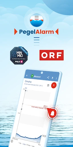
FloodAlert Waterlevel Alerts occupies a critical niche within the Weather category, moving beyond general meteorology into specialized hydrological safety. As extreme weather events become more frequent, this app serves as a vital early-warning system by aggregating data from over 30,000 measuring points across the USA and Europe. It transitions from a simple data viewer to a life-saving tool by providing actionable intelligence through customizable thresholds and emergency protocols. Its professional-grade approach makes it a standout utility for both civilian safety and professional rescue coordination.
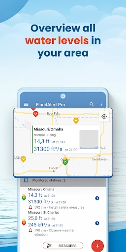
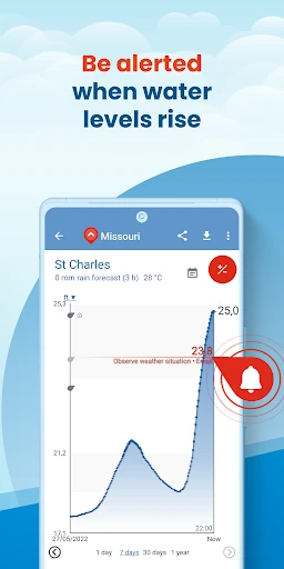
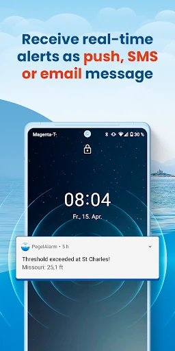
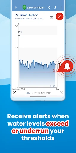
The interface of FloodAlert Waterlevel Alerts prioritizes utility and clarity, which is the standard for high-stakes emergency applications. The use of color-coded rain radar (yellow to violet) follows industry-standard meteorological visualizations, making it instantly recognizable to weather enthusiasts. The threshold setting process is designed to be granular yet accessible, ensuring that users can configure complex alerts without a steep learning curve. While the design is data-heavy—featuring historical charts and CSV exports—it maintains a logical flow that leads the user from "What is happening now?" to "What action should I take?"
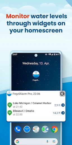
To further enhance its utility, the app could benefit from the integration of home-screen widgets for at-a-glance monitoring of specific gauging stations. Additionally, implementing "Crowdsourced Reporting" could allow users to upload real-time photos of local flooding, providing visual verification to complement the sensor data. Finally, deeper integration with smart home ecosystems—such as triggering connected lights to flash red during a critical flood alert—would provide another layer of safety for sleeping residents.
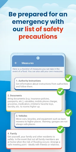
FloodAlert Waterlevel Alerts is a "must-have" for residents in flood plains, water sports enthusiasts, and professional emergency responders like fire departments. While casual users might find the depth of hydrological data more than they require, the app’s ability to provide localized, threshold-based warnings makes it an indispensable tool for disaster prevention. For anyone whose property or safety depends on the ebb and flow of rivers and tides, this is one of the most robust solutions available on the Google Play Store.